BIODIVERSITY, LAND USE AND LANDSCAPE CHANGE
At the end of 2024, the CERN site spanned 624 hectares, broken down into 116 hectares dedicated to buildings and road infrastructure, 413 hectares of cultivated fields, meadows and recreational areas and 95 hectares of forests and woodland.
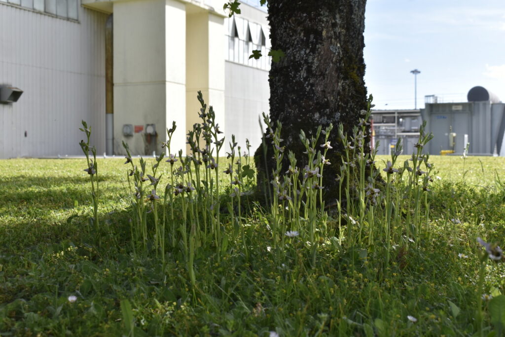
It also includes four wetlands. All these areas harbour a rich diversity of wildlife, including rare species. CERN has implemented a dedicated programme that ensures environmental preservation, fostering biodiversity while meeting the Organization’s evolving needs with minimal impact.
THE CERN MASTERPLAN
CERN’s Masterplan, first published in 2015 and revised in 2021, reflects the Organization’s vision for the period until 2040. This important tool reflects the current and future needs of the Laboratory, including potential development outside the present fenced area, along with those of its neighbours. It centres on four pillars: urban planning, mobility, environmental protection and landscaping, and serves as a guide for the Organization to ensure optimal, coherent growth while balancing operational efficiency, energy use and environmental considerations.
CERN’s fenced site is constantly evolving, and specific areas are consequently impacted. Every consideration is therefore given to minimising the environmental impact of planned works or work to consolidate external spaces (e.g. building construction, consolidation of a car park, roof renovation) that are deemed essential for the continued good functioning of the Organization. In such cases, certifications such as BREEAM (Building Research Establishment Environmental Assessment Method) provide a solid framework for taking all environmental aspects into account, from the design phase to construction and operation. The BREEAM approach entails evaluating a future building’s environmental performance according to multiple criteria, including energy, water management, greenhouse gas emissions, interior air quality, use of sustainable materials, waste management, ecology and biodiversity. This methodology has notably been followed for the design of a new emblematic building on the Prévessin site that was initiated in 2023, whose construction is due to be completed by 2027. This state-of-the-art building of some 13 000 m2 is intended to provide office space for approximately 475 people, as well as laboratory and workshop space, meeting rooms and a restaurant. The certification’s findings allow the development of suitable measures to integrate this building into the environment as efficiently and effectively as possible in order to optimise the preservation of the ecological surroundings and biodiversity based on the initial state surveys.
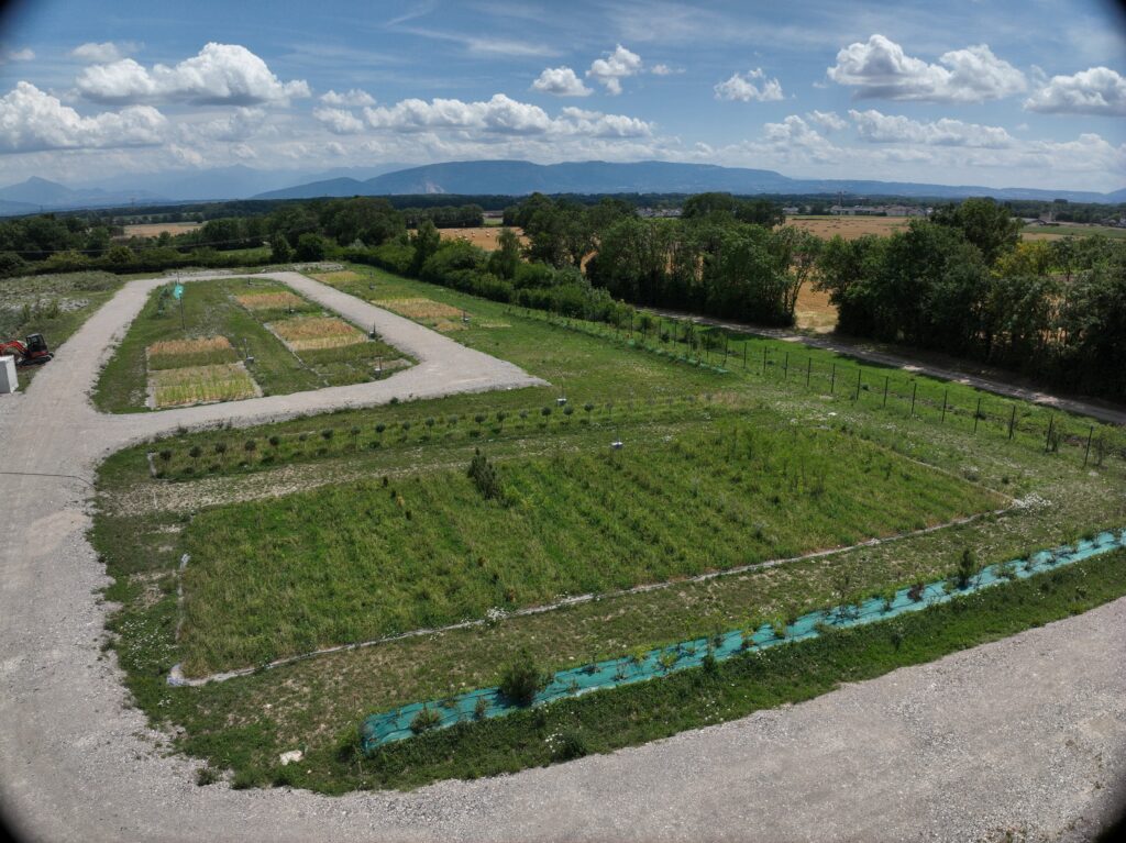
Environmental preoccupations are considered at the very beginning of large projects. For example, the creation of the Open Sky Laboratory (OSL) at the LHC Point 5 site in Cessy, France, has converted 10 000 m2 of CERN land, part of which was formerly used for HL-LHC works, into a dedicated area for tests of molasse (sedimentary rocks) extracted during the HL-LHC excavations. The objective of the OSL is to determine the feasibility of transforming the molasse into functional soil, using natural substances only, for use in landscaping, forestry and renaturation.
The reuse potential of the excavation material is one of the factors that will contribute to the environmental acceptability and cost efficiency of constructing future underground accelerator projects.
Optimising the use of existing infrastructure is central to CERN’s consolidation approach. In this context, continuous efforts are made to review the need for storage spaces to prevent them from encroaching on green spaces and to optimise their management through better centralisation and consolidation. This aligns with the Organization’s strategy, which emphasises avoiding and reducing environmental impacts as a priority. Where such impact is unavoidable, comprehensive plans are developed to implement measures aimed to reduce it. Compensation is only considered as a last resort, when all impacts have not been avoided or sufficiently reduced.
Further, a study has been initiated, with the support of the Canton of Geneva, to develop a comprehensive landscape integration charter that will supplement the CERN Masterplan and is aligned with the Swiss sectoral plan and CERN’s future needs. The results of this study will be published in future reports.
PRESERVING THE LANDSCAPE, FOSTERING BIODIVERSITY
CERN has implemented several measures to promote biodiversity on its land, following an approach based on low-intensity maintenance to foster biodiversity preservation, keeping watering to a minimum and avoiding fertilisers and chemicals wherever possible. Late mowing allows plants and animals to complete their reproductive cycle, while grazing with sheep supports meadow management of dedicated sectors that cover a total of 10 hectares on the Meyrin site and 25 hectares on the Prévessin site.
CERN’s 2021-2025 biodiversity action plan, developed by a dedicated biodiversity working group set up in 2020 and founded upon Host State regulations and best practices in the field of biodiversity, comprises a set of initiatives to preserve and enhance the Organization’s natural environment. The inventory of fauna and flora completed in 2022 identified some 50 hectares of areas of ecological interest, to be classed as a priority for preservation in the event of any planned works and projects. This data is now fully integrated in the Organization’s Geographical Information System (GIS) database. In the meantime, the inventory was complemented by a detailed census of the diverse species of trees around the sites, and their actual size and crown diameter were integrated in the GIS database to ensure better understanding of the CERN environment and improved management and monitoring of the impact of projects and worksites. Among the more than 2 200 trees that were inventoried, a number of remarkable species were identified, including old oak, ash and lime. A further action based on the inventory in the reporting period consisted in the creation of an online, virtual walk around the CERN sites to allow everyone to discover its biodiversity on an interactive journey.
In addition to its fenced site, CERN owns 95 hectares of forests and woodland, the majority of which are located in France and are jointly managed by CERN and the French forestry commission (Office National des Forêts – ONF). In the reporting period, a forest management plan with a biodiversity focus was developed for CERN’s forest plots. Developed in collaboration with the ONF and due to be published in March 2025, this plan aims to enhance the ecological function of the areas concerned through targeted management strategies. Some of these strategies include free evolution, trail security and fencing, selective harvesting to enhance mature trees, enrichment through anticipatory planting to support natural regeneration, seed-based regeneration from standing trees, and improvement cutting to promote biodiversity.
Future efforts in the context of biodiversity preservation will include reducing light pollution, combating invasive species, promoting sustainable agriculture and creating a tree-planting plan to mitigate heat islands (see In Focus).
GOALS FOR 2030
By 2030, CERN’s objective with respect to biodiversity is to conserve and enhance the Organization’s natural, agricultural and forest areas, by preserving fauna and flora in the identified areas of ecological interest (shrublands, meadows, woodlands and wetlands) and reducing the presence of urban heat islands on the CERN sites.
IN FOCUS
Jean-Paul Bergoeing is an environmental engineer in the Environmental Prevention section of CERN’s Environment group.
— What is the importance of the heat islands study and how did you go about it?
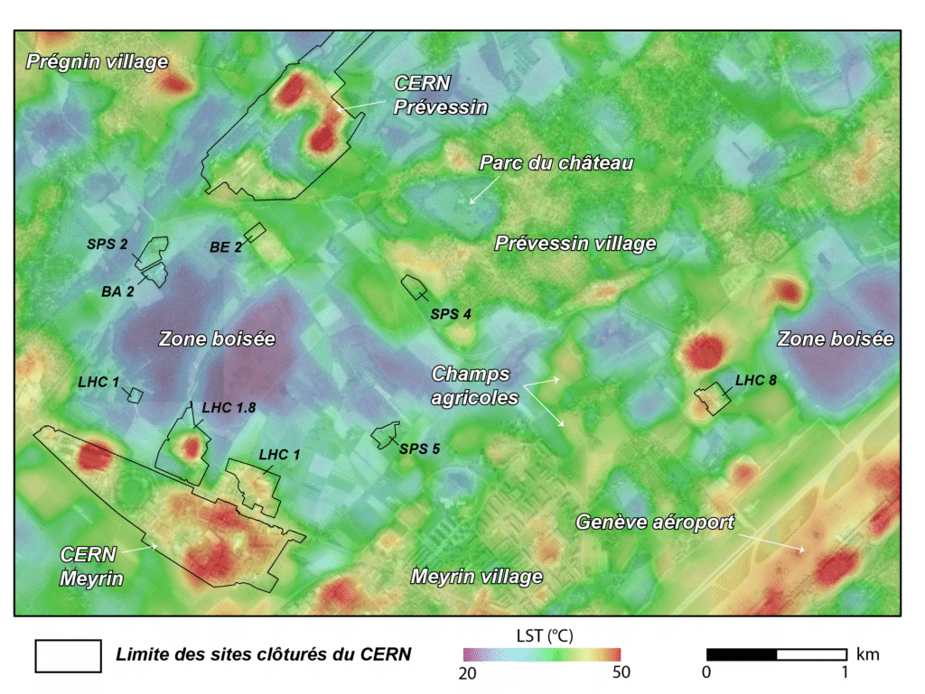
JPB: The study of heat islands is important to understand how urbanised areas can create local temperature increases compared to their surroundings, often referred to as “urban heat islands” (UHI). These temperature differences may have health and environmental impacts, affecting the comfort and productivity of personnel, increasing energy consumption, disrupting the local fauna and flora and worsening air quality, particularly during extreme heat waves.
Our study used geomatic data-processing techniques to characterise CERN’s tree cover and assess heat distribution. We applied a remote sensing approach using Landsat-8 images, which affords access to large amounts of data and wide spatial coverage. Landsat-8 is a satellite that captures high-resolution images of the planet that are in the visible, near-infrared and thermal infrared spectrum, providing detailed information about the Earth’s surface. Using this information we can infer the Land Surface Temperature (LST) as an indication of the intensity of UHI phenomena.
— What has CERN learned from this study and how will it be used in future planning?
JPB: The study highlighted the areas of CERN’s fenced sites that present surface temperatures significantly higher than the surrounding ambient temperature, with impermeable parking surfaces and building rooftops contributing to this issue.
In addition, CERN found that the areas with low tree canopy cover and impermeable surfaces are the hottest, proving that a reduced tree canopy plays a critical role in generating the UHI effect. Thankfully, space for new trees exists in roughly 35% of the total surface of the fenced sites, including some 4% on currently impermeable surfaces such as car parks.
This information can be used to create a tailored tree-planting plan that takes different types of heat islands, complex infrastructure constraints and personnel needs into account. The outcome of this study will be used in future planning to foster a cooler, healthier campus. The data will also guide the creation of a vegetation strategy to mitigate the urban heat island effect and simultaneously enhance biodiversity and ecosystems on the CERN site.